44°24.720′ N / 008°56.580′ E · WORLD GRID ACTIVE
GLOBAL
NAUTICAL
PLOTTER.
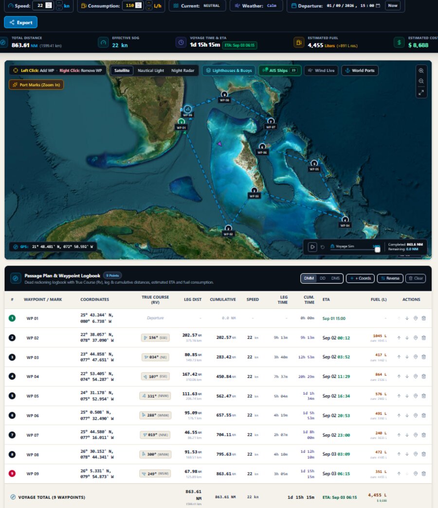
Drop waypoints on a satellite or nautical chart and the plotter builds the full passage for you: true course and distance to the tenth of a mile on every leg, leg time and ETA recalculated the instant you change speed or add a stop. Set your boat's burn rate and it projects fuel consumption and total cost for the voyage, reserve included — no separate spreadsheet, no guessing. Overlay live wind, lighthouses, buoys and world ports directly on the chart while you plan. Every route is saved as a waypoint logbook you can reopen, tweak and reuse for the next trip, and you can run the whole passage as a voyage simulation before a single line is cast off.
For planning and educational use. Not a substitute for approved charts, notices to mariners or proper navigation practice. · Back to Analogic Edition
CLICK TO ZOOM